Long-range snow predictions have suggested La Niña will sweep through North America this winter. It’ll be the third winter in a row, and so it’s dubbed the ‘triple-dip’.
Three years on the trot is a pretty rare occurrence and, due to the last two winters not dropping quite as much as expected, signs point to it being a bumper season in parts of North America.
What is La Niña?
La Niña is a weather pattern that occurs in the Pacific Ocean, when water gets colder due to trade winds moving air masses and pushing water around. Strong winds blow warm water at the ocean’s surface and cold water from the deep rises to the surface. It has wide-ranging ripple effects on the weather.
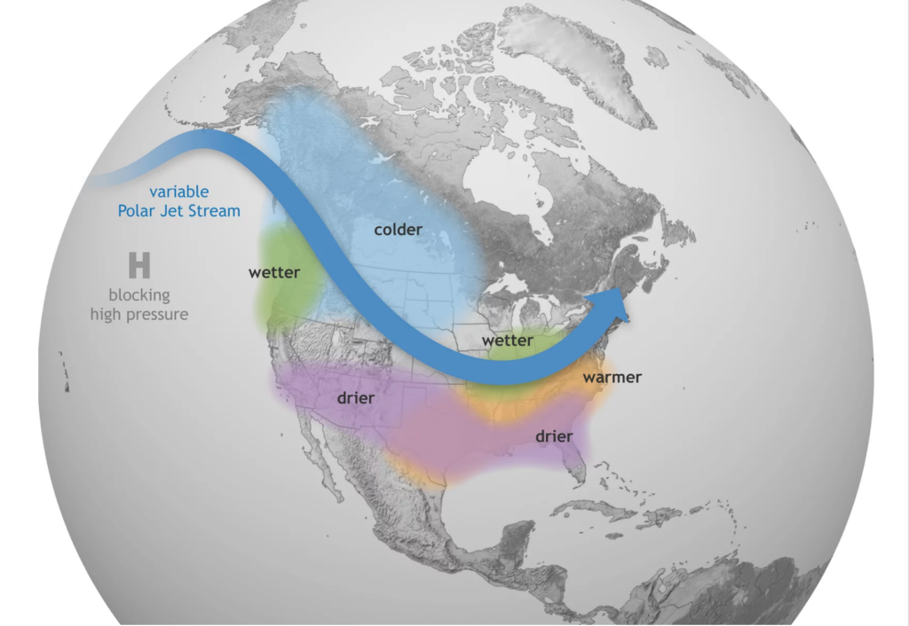
For skiers, La Niña means a colder winter with lots of snowfall. If you’re in the right place…
Last November, La Niña dumped on British Columbia. Low down, at sea level in Vancouver, rain caused flooding but up high at Whistler-Blackcomb that precipitation fell as snow. Good amounts of it. Whistler had near to 11 metres.
La Niñas typically cause more snowfall in states like Oregon, Washington, Montana and Wyoming – which would include the popular resorts of Mt Bachelor (OR), RED Mountain just over the Washington border in Canada, Big Sky (MT) and Jackson Hole (WY) for example. For mountain west states, including massive ski states Colorado and Utah, the forecast is less clear.
Playing the odds: We all know snow forecasting to be an inherently inexact science. But optimists, a good bet is the Northwest and Northern Rockies.


